
- Where
- Riva Del Garda, Trentino-Alto Adige/South Tyrol
- Directions
- Directions
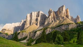
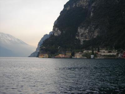
Monte Baldo is a long mountain ridge in the Italian Alps, on the border between the provinces of Trento and Verona, and it forms the dramatic eastern backdrop to Lake Garda, rising steeply from the shore. The ridge runs for about forty kilometres parallel to the lake, between the lake itself on the west and the valley of the Adige river on the east, bounded on the north by the Sella di Loppio, the pass near Mori and Nago, and on the south by low morainic hills, the debris left by the glaciers of the ice age. Its highest point, Cima Valdritta, reaches 2,218 metres, and a number of other summits rise above two thousand metres. The western slopes plunge steeply toward the lake, with steep cliffs and woods, while the eastern side is gentler, which gives the mountain an asymmetrical profile that is visible from across the water, including from Riva del Garda, at the lake’s northern tip. The name is thought to derive from the word for forest, Wald in German, and it appears on a map of 1163, according to local sources.
The mountain is renowned among botanists. Because of its position, with the warm influence of the lake on one side and the cold air of the Alps on the other, and because it escaped some of the effects of the glaciations, Monte Baldo shelters an extraordinary variety of plants, more than 1,800 species, including many rare endemic species. It has been called the Garden of Europe, Hortus Europae, since the 16th century, when naturalists first began to visit it to collect plants, and the flowers bloom in spring and early summer, in meadows, with orchids, gentians and edelweiss. The vegetation changes with altitude, from olive groves and vineyards at the foot, through chestnut and beech woods, to alpine pasture and bare rock at the summit.
Most visitors reach the ridge by cable car from Malcesine, a picturesque town on the eastern shore of Lake Garda, in the province of Verona. The cable car, which is a day trip for those staying in Riva Del Garda, has rotating cabins that give a full panorama as it climbs in two stages, from the lake level to the top station at around 1,750 metres, in about ten minutes. The ascent offers wide views of the lake, the town, its castle and the coast. At the top, there are paths for walking, from gentle strolls on the ridge to longer hikes toward the summits, with views on one side of Lake Garda and the Dolomites and on the other of the Adige valley and the Lessini mountains, and in winter there are ski slopes. Paragliding and hang-gliding are popular, with take-off points on the ridge, and mountain biking trails descend the slopes.
The lifts operate in a regular schedule, which depends on the season and the weather, so check the times and conditions before going, and bring warm clothing, since the top is much cooler than the lake and the weather can change quickly. A visit takes at least half a day. Other places to see in the Riva del Garda area are the Lungolago, with its promenade, and Piazza della Libertà, while the Castello del Buonconsiglio is in Trento. It is the alpine heritage of Northern Italy at its most accessible. The mountain suits walkers, nature lovers, photographers and anyone who loves views.
Categories

More photos coming soon
Nearby Attractions
Other places to visit in Riva Del Garda

Questions people ask
Quick Facts
Best Time to Visit
Visit between May and June or September and October for warm weather and fewer crowds.